Science and Health
Ocean's depth and volume revealed
(Agencies)
Updated: 2010-05-20 07:02
 |
Large Medium Small |
The Earth's oceans are among the most mysterious places on the planet, but scientists now have at least figured out how deep the oceans are and just how much water they hold.
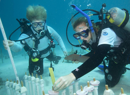 Dr. Jane Lubchenco (L), administrator of the National Oceanic and Atmospheric Administration (NOAA), observes biologist Caitlin Lustic measuring a young farm-raised coral in the Florida Keys National Marine Sanctuary off Key Largo, Florida, April 23, 2010. [Agencies] |
A group of scientists used satellite measurements to get new estimates of these values, which turned out to be 0.3 billion cubic miles (1.332 billion cubic kilometers) for the volume of the oceans and 12,080.7 feet (3,682.2 meters) for the average ocean depth.
Both of these numbers are less than many previous estimates of the ocean's volume and depth.
"A lot of water values are taken for granted," said Matthew Charette, an associate scientist at the Woods Hole Oceanographic Institution (WHOI) in Woods Hole, Mass., who led the new audit of the oceans. "If you want to know the water volume on the planet, you Google it and you get five different numbers, most of them 30- or 40-year-old values."
Crude measurements of volume
The depth estimate of 2.3 miles is about 69 to 167 feet (21 to 51 meters) less than previous estimates. (Some areas of the ocean, such as the Mariana Trench (at nearly 7 miles or 11 km deep) are of course much deeper than the average, while other areas, such as the Mid-Atlantic Ridge are shallower.)
| ||||


That small difference shows how accurate even crude measurement techniques were at estimating the ocean's volume. As long ago as 1888, for example, John Murray dangled lead weights from a rope off a ship to calculate an ocean volume - the product of ocean area and mean ocean depth - just 1.2 percent greater than the figure reported by Charette and his colleague Walter H.F. Smith, a geophysicist at the National Environmental Satellite, Data and Information Service of the National Oceanic and Atmospheric Administration (NOAA).
Starting in the 1920s, researchers using echosounders improved depth estimates significantly, according to the researchers. Most recently, Smith and others have pioneered the use of satellites to calculate ocean volume.
Oceans not losing water
The trend toward a progressive lowering of volume estimates is not because the world's oceans are losing water. Rather, it reflects a greater ability to locate undersea mountain ranges and other formations, which take up space that would otherwise be occupied by water.
Satellite measurements reveal that ocean bottoms "are bumpier and more mountainous than had been imagined," Smith said.
Satellites cannot actually "see" the ocean bottom. Instead, they measure the ocean surface, which reflects what lies beneath. For instance, if a mountain range lurks under a certain part of the ocean, the surface above it will bulge outward.
The satellite project has covered virtually all the world's oceans, except for some areas of the Arctic that are covered with ice, Smith said. The result is a "new world map" of the oceans, he said. "Matt [Charette] and I are seeing a better picture of the shape and volume of oceans."
Fine-tuning the numbers
Satellite measurements do have their shortcomings though: "There is a problem of spatial resolution, like an out-of-focus camera," Smith explained. "We're measuring the sea surface that is affected by mountains, but we're seeing only really big mountains, and in a blurry way. The resolution is 15 times worse than our maps of Mars and the moon."
Consequently, the researchers say, more ship-based measurements are needed to augment and "fine tune" the satellite data. And so far, ship-based sonar and other instrumentation have mapped only 10 percent of the Earth's seafloor.
"We have gaps in echosounding measurements as wide as New Jersey," Smith said.
It would take a single ship 200 years (or 10 ships 20 years) to measure all the ocean-floor depths with an echsounder, according to published US Navy estimates.
The new study, funded in part by the EarthWater Institute, is detailed in the June issue of the journal Oceanography.